Anyone traveling to Summit County, Colorado will have seen Buffalo Mountain – the rounded peak that towers over Silverthorne and I-70. I have spent considerable time hiking, photographing, and skiing throughout Summit County and have always wanted to venture to the summit of Buffalo Mountain and take in the panoramic views. On the spur of the moment this weekend I decided to make it happen.
I arrived at the Lily Pad Lake – Buffalo Mountain trailhead just before dawn on Saturday morning hoping to capture some sunrise images overlooking Lake Dillon. While it was a cool and quiet morning the skies did not cooperate and the sunrise was pretty bland. As luck would have it, I did run into a couple of male moose grazing just above the trailhead but was unable to capture them before they noticed me and ran off.
The hike to the summit of Buffalo Mountain is a fairly short but steep trip covering only 2.75 miles but rising 3,000’ in elevation. The trail begins on a moderate grade (9,774’) and travels through the recent (June 2018) burn area before reaching the Buffalo Mountain trail split (0.6 miles, 9,993’). The burn area is eerie in the early morning light with a mix of blacken trees and those still covered in the fading red of the fire retardant sprayed a couple months before. Amongst the burned and blackened tree trunks and fallen logs brightly colored wildflowers are growing here and there, signs of new growth already returning to this section of forest.
After the split, the trail begins an arduous climb up steep, rocky, winding switchbacks with intermittent views of Lake Dillon and the surrounding towns of Silverthorne and Dillon. The path rises quickly through the forest, ending abruptly at a large talus field (1.7 miles, 11,395’). The pace slows considerably here as the route through the talus is steep, windy, and uneven and guided by well-placed cairns.
After picking my way through the wobbly talus for what seemed like forever, I crested a ridge, left the talus field behind, and entered open tundra (2.1 miles, 12,025’). While the footing improved significantly, the steep grade continued up the northeast slope with the summit now visible. On the way up the trail I encountered a single mountain goat bounding down from the summit. As we passed on the trail we were only about 15-20 yards apart and I was able to take several good wildlife photographs.
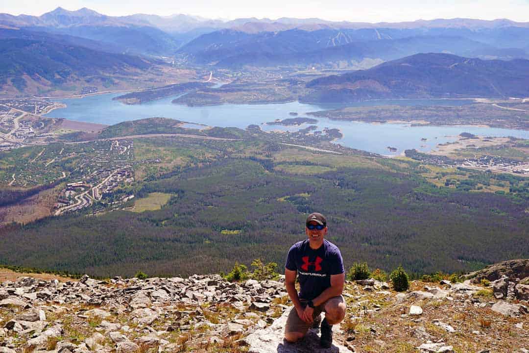
Leaving the goat behind I continued up the steep, rocky approach to the top, eventually reaching the summit (2.75 miles, 12,777’). The commanding 360 degree views overlooking Lake Dillon, Silverthorne, Dillon and Frisco on this beautiful summer morning made the trip well worth the effort. After a quick snack and a chat with some fellow hikers at the summit I took a few panoramic images from the summit and made my way back down to the trailhead for the drive home, happy to have checked this long sought after peak off my list.
Loved what you just read?
Become a VIP Insider and get more of the good stuff – exclusive tips, insider updates, behind-the-scenes stories, and special promotions delivered straight to your inbox.
Don’t miss out—our VIP members get the best of everything first